Tulum Ruins
Tulum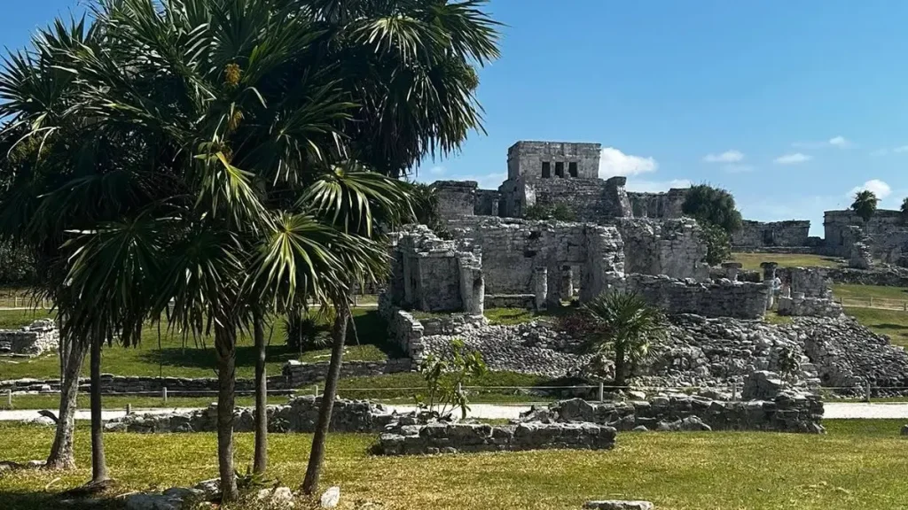
How to get to Tulum Ruins
The entrance is just north of Tulum town. You can get there by car, taxi, bike, or local colectivo.
About Tulum Ruins
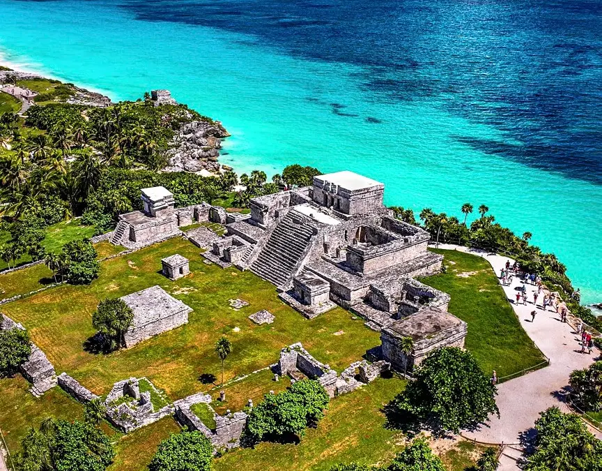
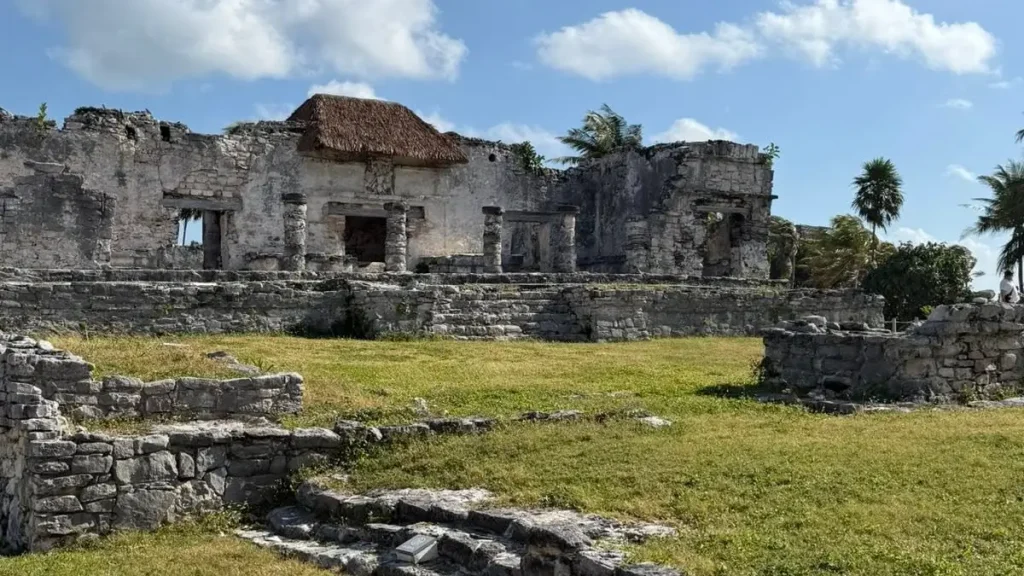
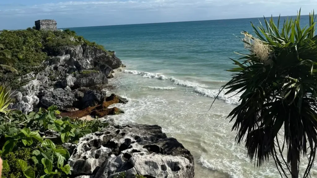
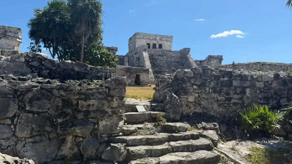
Tulum Ruins sit on a limestone cliff above the turquoise Caribbean Sea, making them one of the most dramatically positioned Maya archaeological sites in the world. Tulum’s compact walled layout and breathtaking coastal setting make it one of the most memorable stops on any Riviera Maya itinerary.
The site dates to the late post-Classic period, roughly between AD 1200 and 1521, when it served as an important port for Maya coastal trade. Its original name was Zama, meaning “Dawn” — a fitting name for a city that faces east and catches the first light of day over the sea. The name Tulum, Maya for “wall,” came later, named after the imposing stone walls that protect three sides of the city, with the fourth side opening directly to the cliff edge and sea below.
El Castillo, the tall pyramid at the site’s highest point, once served as a lighthouse and ceremonial center. The Temple of the Descending God features a distinctive upside-down deity carving, and the Temple of the Frescoes bears the face of the rain god Chaac on its carved cornices. Many buildings were originally painted in bright red, blue, and yellow, and traces of painted stucco remain visible on some walls today.
At the time of the Spanish Conquest, around 600 people lived here, supervising coastal trade routes from Honduras to the Yucatán. The city survived approximately 70 years after the conquest before being abandoned. Today it is one of the most visited archaeological sites in Mexico.
Timing matters here. Crowds build fast, with tour groups typically arriving by mid-morning. An early start gives you a calmer atmosphere, better light for photographs, and more comfortable temperatures before the heat sets in. The site is compact and can be explored in under two hours, leaving plenty of time to continue to a nearby cenote or beach club.
Location
Related Attractions
Frequently Asked Questions about Tulum Ruins
What is Tulum Ruins and why is it worth visiting?
Tulum Ruins is an ancient Maya walled city perched on a cliff above the Caribbean Sea in Quintana Roo, Mexico. It dates to the late post-Classic period, roughly between AD 1200 and 1521, and served as an important coastal trading port. What makes it worth visiting is the rare combination of genuine archaeological significance and one of the most dramatic natural settings of any ruin site in the Americas — the views over the turquoise sea below are genuinely unforgettable, and the sense of standing inside a real ancient coastal city is hard to replicate anywhere else in the region.
What is the best time to visit Tulum Ruins to avoid crowds?
The best time to visit is as early as possible, ideally when the site opens. Large tour groups typically arrive between 9:30 AM and 11:00 AM, so arriving at or before opening gives you a calmer experience and much better conditions for photography. The site faces east, making morning light particularly beautiful on the main structures. Late afternoon can also be quieter, but midday is the most crowded and hottest period and is best avoided if you have flexibility in your schedule.
Can you swim at the beach below Tulum Ruins?
There is a small beach directly below the cliff at Tulum Ruins, accessible from within the site. Swimming is sometimes possible when conditions are calm, but access can change based on weather, tides, and site management decisions. Lifeguards and colored warning flags indicate conditions on a given day. If your main goal is a proper swim, the beaches around Tulum town and along the hotel zone to the south are a much better choice, offering more space, better facilities, and more consistent access.
Do you need a guide at Tulum Ruins or can you explore on your own?
You can explore on your own without a guide. The site is compact with a clear prescribed walking route and bilingual signs at the main structures. However, a licensed guide significantly enriches the experience by pointing out architectural details, explaining the site's function as a coastal trading port, and providing historical context that is easy to miss without prior knowledge. Licensed guides typically wait at the entrance and offer tours in English, Spanish, French, and other languages for small groups.
How do you get to Tulum Ruins from Cancun or Playa del Carmen?
Tulum Ruins are approximately 130 kilometers south of Cancun and 60 kilometers south of Playa del Carmen along Highway 307. By car or taxi, the entrance is clearly signposted just north of Tulum town. ADO buses run regularly between Cancun, Playa del Carmen, and Tulum town, from where a short taxi or colectivo ride reaches the ruins. Many hotels and tour operators offer organized day trips with transportation included. A rental car gives the most flexibility for combining the ruins with nearby cenotes or beach stops.
What else can you combine with a visit to Tulum Ruins?
Tulum Ruins combine naturally with several nearby attractions. Cenote Dos Ojos and the Gran Cenote are both within 20 minutes by car and are among the most beautiful cenotes in the region. The Tulum Hotel Zone beach road, just south of the ruins, has some of the whitest sand and clearest water on the entire Riviera Maya coast. Xel-Ha, a natural aquatic park about 10 kilometers to the north, is a good afternoon add-on for families. Cobá Ruins, about 40 kilometers inland, is another option for those wanting two archaeological sites on the same day.
Rating Overview
No reviews yet. Be the first to leave a review!
Leave a Reply